Palestine
Palestine, or the Occupied Palestinian Territory (OPT), is located between the Mediterranean Sea, the Jordan River and the Dead Sea. The OPTis composed of two enclaves: the West Bank, including East Jerusalem and Gaza Strip.
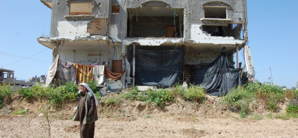
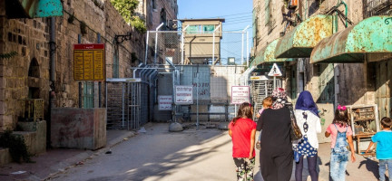
Land management and administration stakeholders in Palestine operate in a unique context. The complex and outdated legal framework composed of numerous Ottoman, British, Jordanian and Egyptian laws and Israeli military orders limits the ability of Palestinian land authorities to effectively execute their duties. The ongoing confiscation of land, demolition of houses, imposition of closures, sieges of urban areas, control of the resources required for sustainable development, and the division of the West Bank and Gaza into three areas (A, B and C) after the 1995 Oslo agreement are some of the most pressing challenges to sustainable land management in the OPT. In spite of these challenges, Palestine has achieved important advances in the land sector, particularly regarding land registration, digitalisation and data protection, and the management of state properties
The information contained in this page gives an overview of the Palestine land sector. More detailed information and analysis can be found in the “Land governance and land rights in Palestine: Analysis and recommendations” report developed by UN-Habitat and the Global Land Tool Network in the context of the Arab Land Initiative. The report presents a more detailed analysis of the legal and institutional setup and of the land sector stakeholders in Palestine. It describes the land administration functions (land tenure, land value, land use, land development, and land disputes resolution) and provides a set of recommendations on how to improve land management and administration in Palestine.
Land tenure
Palestine’s pluralistic land tenure system includes statutory, religious and communal land tenure (musha) systems, in addition to informal rights. Mulk or privately owned land and state land registered with the Land Registration (Tabu) Department of the Palestinian Land Authority (PLA) make up the statutory part. The religious land tenure system (waqf) includes religious land endowments, or mulk land, dedicated to pious uses. Communal land tenure, or musha, is community-owned cropland without necessarily a written title, characterized by a periodic redistribution of agricultural plots among peasant cultivators. It is still used today in some places (e.g. collective ownership of the Sanour Plains in Jenin).
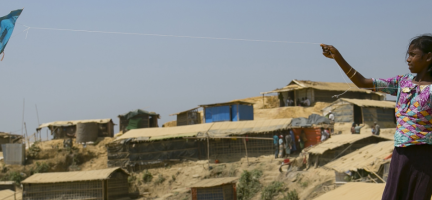
The informal tenure system includes the refugee camps in the West Bank and the Gaza Strip. The refugees do not “own” but have the right to “use” the land to build a shelter for a residence. The lease agreements last 99 years, after which the land reverts to the original owner. Same goes to some of the Bedouin communities across the West Bank territory[1].
Regarding ownership, the Ottoman Land Code of 1858 (which still applies in the West Bank and the Gaza Strip) defines five main types. The three principal ones – mulk, miri and mewat – are determined by a combination of spatial features (geographic location) and functional characteristics (type of land and its use). The two secondary types – waqf and metrouke – are classified solely on land use.
There are two types of private lands in Palestine: private land registered with the Land Registration Department and unregistered private land, also known as “finance land”, which is un-surveyed land handled by the Ministry of Finance’s (MoF) Property Tax Directorate. Public, or state lands, are restricted to lands that are subject to government control and used in the execution of its competencies (e.g. the erection of government buildings).
The land registration systems in Palestine include two types: mandatory registration, i.e. Systematic Land Registration (SLR), and optional registration, i.e. New Registration. Data from the Land and Water Settlement Commission (LWSC) indicate that only 62 per cent of West Bank land is registered, with unregistered properties concentrated in urban centres. In the Gaza Strip, 98 per cent of the land is already registered.
Land settlement is the process of settling ownership and titling issues related to land and water, following the Law of Settlement of Lands and Waters No. (4) for the year 1952. The total area of the West Bank is approximately 5.65 million dunums. Before 1967, approximately 1.91 million dunums (or 34 per cent of the total area) were settled by the Jordanian rule. However, by 1968, the Israeli occupying power imposed Military Order No. 291 of 1968, which suspended land registration process in the West Bank. This suspension proceeded until 2006, where the Palestinian Land Authority (PLA), with support from the World Bank, resumed land registration and completed the registration of 63,000 dunums (or 1 per cent of the total area), mainly in Areas A and B. To accelerate the land settlement process, and in support of the Road Map for Reforming the Palestinian Land Sector that was endorsed by the Cabinet in 2017, the LWSC was established as an independent body in March 2016. Since 2016, LWSC has completed additional 28 per cent in terms of land settlement.
Two pieces of Jordanian legislation govern land and property registration in Palestine: the Law of Settlement of Lands and Waters No. (4) for the year 1952 (mandatory registration of properties by the LWSC), and the Immovable Assets Registration Law for the Never Registered Assets No. 6 of 1964 and its amendments (optional registration). The surveying department at the PLA is responsible for the property’s initial registration and also examines the maps and plans prepared for land adjudication process, partition, subdivision and other land transactions. Registration is different from settlement in that it deals with land already covered by settlement.
Palestine faces several pressing land registration challenges: complex registration procedures; a mostly manual process; weak PLA institutional capacity; shortage of settlement judges; limited provision of e-services for government agencies and institutions, businesses and citizens; and weak community awareness of the importance of land registration and its procedures.
Accelerating SLR can achieve several benefits, such as providing collateral for loans, improving the housing market and the construction sector, progressively increasing taxation revenues through property tax, and reducing land disputes, conflicts and legal uncertainties.
Ongoing land registration initiatives include the Land Sector Strategy for Palestine (2021–2023), based on the Road Map for Reforming the Palestinian Land Sector, which aims to achieve the following main objectives: consolidating and protecting property rights, raising the efficiency and production capacity for land transactions, conducting a comprehensive valuation of registered property, standardizing the geodetic reference, and protecting and developing state land. Moreover, supported by international partners, the PLA and LWSC are working to survey and register land in the West Bank and to modernize land registry services. Furthermore, the LWSC and PLA are collaborating with the World Bank on the Real Estate Registration Project, which aims to enhance tenure security and improve real estate registration services, focusing on the urban areas in area A and B. With EU financial support, UN-Habitat and the LWSC are implementing the project Achieving Planning and Land Rights in Area C, West Bank – Palestine (2019–2023), which is focused on rural areas, primarily in Area C.
The Palestinian Civil Code (PCC) No. 4 of 2012 determines the following main ways to acquire the right to property and land registration: authorized occupation (Articles 989–998), inheritance (Articles 998-999), will and testament (Articles 1038–1042), inter vivos property transfer (Articles 1043–1053), contract (Article 1055), pre-emption or the right of pre-emption (Articles 1056–1071) and possession (Articles 1072–1106).
The two types of new land classifications that emerged during the conflict – i) Former Settlement Land and ii) Refugee Camp Land – remain unsettled and, therefore, pose additional challenges and complexities to land administration in the Gaza Strip.
For more information and the references, see the “Land governance and land rights in Palestine: Analysis and recommendations” report by UN-Habitat.
Land value
Land value functions include assessing the value of land and properties, calculating and gathering revenues through taxation, and the management and adjudication of land valuation and taxation disputes. Property valuation is based on different laws in the West Bank than in the Gaza Strip. In the West Bank, the currently applicable laws are Jordanian Law No. 11 of 1954, “Tax on Buildings and Lands in the Region of Municipalities and Local Council”, and its amendments, and Land Tax Law No. 30 of 1955, imposing taxes on lands outside municipal borders. Law No. 42 of 1940, “Properties Inside the Cities Tax”, regulates property valuation in Gaza.
Rent value (for buildings) and market value (for land) are prescribed for property valuation in the legislation. The rent value for a unit in a building can be obtained from a contract that is agreed by both lessor and lessee; thus, the actual rent value can be directly entered into the database. Market value is the estimated figure for which a property should transfer from a willing seller to a willing buyer on the date of valuation, with each party acting knowledgeably, prudently and without compulsion.
Property valuation is underdeveloped and further hampered by many challenges: lack of a unified system, clear and approved criteria and bases for valuation; absence of a single authorized institution to deal with this issue; reassessment is carried out every five years and not annually; international valuation standards are not used, and there is no quality control or compliance with international valuation standards; the valuation process is vulnerable to corruption and often results in the registration of lower‐than‐market values; and there is no law regulating the licensing of appraisers.
The PLA is developing a valuation system to increase market transparency, to reduce banking sector/mortgage risk, to improve the infrastructure for a recurrent property tax, and to meet the third sectoral strategic goal of the Land Sector Strategy (2020–2023), the comprehensive valuation of all registered immovable property. Moreover, the General Directorate of Property Tax (GDPT) of the MoF, in cooperation with the Japan International Cooperation Agency (JICA), developed property valuation standards, a technical manual and a handbook for valuators (yet to be officially adopted).
Concerning land and property taxation, the legal framework for land and property taxation in the areas under the Palestinian Authority is composed mainly of the following legislation: the Buildings and Lands in the Region of Municipalities and Local Government Tax Law No. 11 of 1954, the Land Tax Law No. 30 of 1955, and Jordanian amendments until 1967, as well as Israeli military orders (in effect in the West Bank). British laws related to property tax, including British Property Tax Law No. 42 of 1940, “Property within Cities Tax Law”, apply in the Gaza Strip.
The buildings and lands tax (daribet al-musaqafat) in Palestine equals 17 per cent of the stated rental value in the contract (buildings), after deducting 20 per cent as depreciation, or of the assessed value of rental income and a six-per-thousand share of the sale value (unbuilt land). These revenues are distributed between the public treasury and the local authorities by 10 per cent for the first and 90 for the second. Property tax revenues in Palestine are low, which can be explained, on the one hand, by the outdated legislative framework governing property tax and, on the other, by the lack of valuation standards to objectively assess real property. To improve property tax revenues in Palestine, the GDPT of the MoF signed a cooperation agreement with JICA in 2016. The resulting “Project for Improvement of Local Finance System in Palestine” provides technical assistance to the GDPT to improve its valuation and collection capacity, by using reliable property tax valuation standards and capacity-building of property tax staff.
There is no inheritance tax, stamp duty or transfer tax in Palestine. Capital gains of individuals from the sale of investments (e.g. tangible assets and real property) are tax-exempt when not held for trading. Corporate capital gains from the sale of investments in equity securities and bonds are tax-exempt. Capital gains are taxable at the customary 15 per cent corporate tax rate when they derive from the sale of tangible assets and real property.
For more information and the references, see the “Land governance and land rights in Palestine: Analysis and recommendations” report by UN-Habitat.
Land use
The Palestinian Land Use Classification System, which includes seven categories branching down into subcategories, was developed based on the UNECE land use classification system. It is suitable for the Palestinian case because it depends on methods and sources for producing land-use data, such as administrative records and analysis of aerial and satellite images. The classes it uses are almost the same as those available in the OPT (PCBS, 2000).
Land use in Palestine is challenged by rapid urbanization, high population growth rates, land scarcity and territorial fragmentation under the ongoing occupation (UN-Habitat, n.d.), in addition to agricultural land fragmentation due to competition between heirs (MAS, 2005). The West Bank was divided into Areas A, B and C as part of the Oslo Accords. As a result, Israel could maintain full control over Area C (61 per cent of the territory and only 4 per cent of the Palestinian population). Palestinians were granted control over Area A and partially over Area B, the main urban areas. These restrictions negatively impacted the Palestinian physical environment and led to unbalanced urban development (UN-Habitat, n.d.). Israel’s control over water and systematic water deprivation is suffocating Palestinian farming by forcing farmers to abandon their lands and look for alternative livelihoods. Over 70 per cent of communities (mostly in Area C) lack connection to the water network and must rely on very expensive tanker water (Abdel Razek-Faoder and Dajani, 2013).
Agricultural land fragmentation is largely the result of multiplicity of heirs and the different values of land based on its geographical location (water, electricity, roads, sewage networks, proximity to residential communities and Israeli settlements), its fertility (and whether currently exploited), as well as its legal status (whether construction is allowed) (MAS, 2005; Al-Nobani, 2017).
To improve land use, the Palestinian Authority adopted the following national land-use strategies:
The Ministry of Agriculture’s National Agricultural Sector Strategy (NASS) 2017–2022. It has five strategic objectives: i) enhance resilience and steadfastness of female and male farmers on their lands; ii) sustainably adapt natural and agricultural resources to climate change; iii) increase agricultural production and productivity; iv) improve access to quality agricultural services for female and male farmers and entrepreneurs, to increase value along agricultural value chains; and v) develop an effective and efficient institutional and legal frameworks (MoA, 2016).
The National Adaptation Plan (NAP) to Climate Change 2016. Twelve sectors potentially vulnerable to climate change have been identified (see Figure 14 below), and the NAP assessed their degree of vulnerability to aid identification and prioritization of adaptation options (EQA, 2016).
The National Strategy, Action Programme, and Integrated Financing Strategy to Combat Desertification in the occupied Palestinian territory (NAP-IFS). Formulated by the Environment Quality Authority of the PNA, its objective is to prevent, halt and where possible reverse the effect of desertification, land degradation and drought. These efforts would alleviate poverty, improve livelihoods and support sustainable development (EQA, 2012). See Annex 2 for a summary of the strategic objectives and NAP programmes and interventions.
State of Palestine Cross-Sectoral Environment Strategy (2020–2023). It seeks to achieve five objectives (EQA, 2020): i) low and controlled environmental pollution levels; ii) natural environment and biodiversity conservation; iii) putting in place the necessary measures to adapt to climate change; iv) updating the environmental legislative system; and v) enhancing environmental awareness, knowledge and behaviour.
For more information and the references, see the “Land governance and land rights in Palestine: Analysis and recommendations” report by UN-Habitat.
Land development
The Palestinian Authority, represented by the Ministry of Local Government (MoLG) and the MoF, took on the task of elaborating strategic development plans for all governorates, finalizing those for Jenin (2008), Nablus (2010), Salfit (2012) and Tulkarm (2014). The plans are combined with investment in social infrastructure based on community-driven action plans. These provide a protective mechanism against displacement and demolitions, strengthening community resilience. The plans and social infrastructure are in line with the real needs of the local population and are formally endorsed by the local communities and the MoLG.
National Spatial Planning (2050). In 2015, the Palestinian Government created the National Spatial Plan “Envisioning Palestine 2025, 2050”, supported by UN-Habitat, UNDP and other partners. It defines a long-term vision for comprehensive development that, at the same time, can ensure environmental security and sustainable development, with optimal use of available resources and potentials. It captures a broad perspective framework for the main visions and subvisions in seven sectors: i) economic development, ii) resources management, iii) urban and rural development, iv) infrastructure, v) demography and society, vi) international relations and politics, and vii) the service sector (see Annex 3) (PNA, 2015).
The Spatial Development Strategic Framework for Jerusalem, Ramallah and Al-Bireh, and Hebron Governorates (2030). These documents were elaborated under the “Fostering Tenure Security and Resilience of Palestinian Communities through Spatial Economic Planning Interventions in Area C (2017–2020)” Project with the following main objectives:
Diagnose the current status of the sector’s administration and good governance, infrastructure and environment, social and economic development.
Identify the obstacles and opportunities for the development process in the governorate and formulate a comprehensive development vision up to 2030.
Set integrated spatial development goals with special emphasis on the identified priority sectors.
Identify priority development projects and programmes and locate them spatially.
Develop an integrated implementation plan with a time frame and an estimated budget.
Develop a methodology to monitor the plan’s implementation and progress.
Link the SDSF to the policies and development plans of the National Spatial Plan and sectoral and cross-sectoral plans.
Link and integrate the SDSF to previous plans at the city and governorate level (MoLG, 2020).
Concerning urban planning, the Palestinian planning system follows a top-down, hierarchical approach. The Jordanian Law of 1966 defines three levels of spatial planning: national planning, undertaken by the Higher Planning Council (HPC); regional planning, undertaken by the governorates, and local planning, undertaken by municipalities and village councils. As an occupying power, Israel continues to use the planning and land laws and legal documents from the Jordanian time during the 1960s, the British in the 1940s, and some from the Ottoman time. However, a succession of Military Orders (MO), including MO 418 of 1971 (cancelling planning apparatus) and MO 291 of 1968 (stopping land registration processes) introduced by the occupying power also impact on the right to development. The outcome has been that Israeli settlements have been extensively developed in Area C (though illegal under international law) and there are Israeli-only roads, checkpoints and a Separation Barrier. Meanwhile there are extensive demolitions of Palestinian properties, on the grounds that they do not have planning permission/building permits. One reason they do not have such permissions is that statutory plans have not been prepared/approved by the Israeli Civil Administration (ICA) or the ICA has prepared plans that in effect prohibit any development outside the existing built-up area. Demolitions have also taken place of donor funded constructions.
Almost 58 per cent of local government units (LGUs) in Palestine have local outline plans. More than 93 local master plans are currently being prepared to cover the remaining 40 per cent of LGUs (MoLG, 2024).The World Bank worked with five major urban centres – Hebron, Nablus, Bethlehem, Ramallah and Al-Bireh, and Gaza City – through the Integrated Cities and Urban Development Project. This effort focuses on improving the effectiveness of city management systems, including urban and spatial planning, land use and development procedures (WB, 2021). UN-Habitat and the MoLG have developed a National Urban Policy for Palestine, supported by EU funding under the project “Achieving Planning and Land Rights in Area C, West Bank, Palestine” (UN-Habitat and MoLG, 2021) that was endorsed by the Palestinian Cabinet in 2023.
The current Jerusalem Master Plan 2000, commissioned in 1999 and published on 13 September 2004 as the United Jerusalem Town Planning Scheme 2000 (UJTPS), provides a mandatory map for land use and a blueprint for municipal planning up to 2020. It was the first planning framework that included both East and West Jerusalem as a single urban unit under Israeli sovereignty. The UJTPS was meant to replace the one in effect since 1959 (Master Plan 62), which applies only to the west of the city (PASSIA, n.d.).
Urban planning in the Gaza Strip started in 1995 through a Norwegian-funded capacity-building pilot project by laying out a master plan for the city of Gaza. Today, planning is practised on three levels. At the national level, sectoral development plans are drawn. On the regional level, the regional plan laid out in 1998 was not legally sanctioned; however, another version, the Regional Plan for Gaza 2005–2015, was approved. Both plans focus on urban development, land use and the protection of natural resources. On the local level, all 25 local governments in Gaza have already elaborated physical master plans and detailed plans.
The main urban planning and construction legislation in Palestine are the following:
Town Planning Ordinance/Law No. 28 of 1936 and its amendments. Issued by the British High Commissioner on 4 May 1936 to repeal the Planning Ordinance of 1921 and its amendments, it is still applicable in the Gaza Strip. It was amended during the British mandate and several times by Israeli military orders. The Ordinance’s 41 articles cover, among other important issues, the distribution of planning jurisdiction on local, regional and national levels.
Temporary Planning and Building Law No. 79 of 1966 and its amendments (Jordanian Planning Law). This law governs planning processes and is applicable in the West Bank, especially Area C. In addition, several planning by-laws have been developed and passed since 1996 (MoLG, 2016). The Planning Law defines three kinds of planning schemes (NRC, 2012):
Regional plans (Articles 15–18) structure the landscape at the most general level: location of new towns and villages, expansion limits of existing communities, and designating open areas and zones for industry and commerce.
Outline plans (Articles 19–22) must be prepared for cities and large towns, to define land zoning in greater detail than the regional plans.
Detailed plans (Articles 23–24) are divided into two main types: cities and large towns, and small towns and villages. The District Planning Committee has the power to approve detailed plans.
The Regulation of Buildings and Planning No. 6 of 2011 was issued by the Palestinian Council of Ministers on 17 May 2011, based on Article 67 of Planning Law No. 79 of 1966 and Town Planning Ordinance No. 28 of 1936. It applies to lands, buildings and construction projects located inside the planning borders of Palestinian governorates (Article 2).
The Regulation Concerning Multi-Storey Buildings in the Gaza Region of 1994, issued by the head of the PNA on 17 September 1994, deals with the construction of multi-storey buildings in Gaza, in accordance with the stipulated conditions and specifications.
The Regulation of Buildings and Planning No. 31 of 1996 governs construction and planning outside of planned areas, valid in both the West Bank and the Gaza Strip (MoLG, 2013).
The Environment Law No. 7 of 1999, and its amendments, aims to protect the environment from all types of pollution, to integrate environmental protection in economic and social development plans, and to promote sustainable development of vital resources. This law deals with climate change through its objective and general principles, special conditions of the aerobic environment and environmental impact assessment, and references to relevant international treaties (LSE, 2021).
For more information and the references, see the “Land governance and land rights in Palestine: Analysis and recommendations” report by UN-Habitat.
Housing
The fact that 40 per cent of West Bank and 10 per cent of Gaza land are not subject to settlement work poses a major barrier to developing a healthy real estate and housing market (Dodeen, 2014). Other obstacles hamper the smooth operation of the housing market: the lack of enforcement of orders issued by the courts regarding evictions and other claims by property owners; a limited supply of land for new construction; an inadequate system for issuing land titles and building permits; and the inability of municipalities to enforce planning regulations due to their extremely limited control over land (UN-Habitat, 2001).
Selling and purchasing houses in Palestine is relatively rare compared to apartments for several reasons. One main reason is the high prices due to the scarcity of construction land. Accordingly, real estate developers focus on building apartments, particularly in city centres. As a result, the price index for apartments fell from 105.4 in the third quarter of 2021 to 103.7 in the fourth quarter, while the price index for houses rose from 107.9 in the third quarter of 2021 to 108.0 in the fourth quarter of 2021 (PMA, 2022).
Looking at housing and informal settlements, there is no public or social housing in Palestine, even though Palestinian Basic Law guarantees the right to adequate housing for all (Article 23) (OHCHR, 2021). The main challenges to the housing sector and “adequate housing” in Palestine are the lack of adequate control over the limited land available to Palestinians; the lack of tenure security and continuous threats of shelter demolition imposed over 500 Palestinian communities in Area C and the edge of Area A and B by the Israeli Occupation; inadequate housing in refugee camps due to expansion restrictions and the authority gap in service provision between the PA (including municipal governments) and UNRWA; the lack of a housing sector plan, despite the recently completed housing policy; inappropriate legal framework governing housing and construction in Gaza and the West Bank; low housing production due to the financial deficit and inadequate financing mechanisms; and the weak performance of the judiciary in settlement of real estate and housing disputes (MoPWH, 2014). Housing adequacy in Palestine has been also severely affected by the Israeli occupation including settlements expansion and housing demolition.The housing sector needs better integration into urban policies. Inadequate urban planning and weak regulatory frameworks have left little room for government to maneuver against speculation over land, urban sprawl and spatial segregation. (UN-Habitat, 2021)[1]
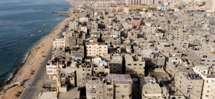
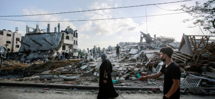
The Ministry of Public Works and Housing (MoPWH) has been working on housing projects and programmes that benefit low-income families. The MoPWH provided governmental land at nominal prices for more than 5,800 households, in addition to accommodating over 4,000 households in 16 housing projects in Gaza. It completed four housing projects in the West Bank and rebuilt and rehabilitated thousands of houses totally or partially destroyed by Israeli forces (MoPWH, 2014). Since 1991, the Palestinian Housing Council (PHC) has dispersed USD 210 million in direct investments, providing housing across the land: 1,178 apartments in Gaza, 408 houses in West Bank cities, 1,325 houses in rural areas and 1,956 apartments in Jerusalem. Moreover, 1,200 shelters have been rehabilitated – including 343 houses in Jerusalem, of which 70 are in the Old City – in addition to 442 units in Gaza (MoPWH, 2014). As a result of the hostilities that erupted in October 2023, as of early February 2024, 80 per cent of the housing stock in the Gaza Strip has been destroyed or damaged, causing the displacement of 1.7 million people (OCHA).
UN-Habitat supported many housing projects in the OPT, including:
Urgent Housing Rehabilitation for Palestinian Families in East Jerusalem: UN-Habitat, in collaboration with the Palestinian Authority and PHC, completed the "Urgent Housing Rehabilitation for Poor and Marginalized Palestinian Families in East Jerusalem" project. This initiative aimed to enhance living conditions for low-income families and disabled individuals residing in deteriorated housing. Over 2,000 families in Jerusalem governorate urgently required assistance. The programme, initially funded by a 500,000 EUR contribution from the French government, selected 56 families for support. Notably, 27 per cent of beneficiaries were female-headed households, and 16 per cent were individuals with chronic illnesses or disabilities. Technical issues like leaking roofs and faulty electricity were addressed, incorporating green building principles for better insulation and energy efficiency. A second phase, backed by an additional 400,000 EUR from France, rehabilitated 45 more houses, focusing on self-help construction and livelihood support.
Reconstruction of Housing Units in Gaza Strip: Since 2011, UN-Habitat and PHC have collaborated to reconstruct 100 housing units in the Gaza Strip for non-refugee families affected by the 2008-2009 conflict. Beneficiaries were trained to manage reconstruction independently or through local contractors, ensuring shelter continuity and empowerment. Cash grants are dispersed based on construction progress, facilitated by technical support centers and mobile units. The project aims to empower families to rebuild according to their needs and available resources while adhering to green measures.
King Abdullah Bin Abdul-Aziz City for Charity Housing in Hebron: In 2007, UN-Habitat partnered with the Hebron municipality and the Ministry of Social Affairs to address urban poverty among women-headed households in Hebron. The project included constructing 100 housing units, providing training and income-generating projects, and promoting neighborhood development and green initiatives. Beneficiaries were selected publicly in 2013, with construction completed in 2014. Women-headed households, now property owners and cooperative shareholders, have integrated into local economic development efforts. This initiative has influenced urban poverty alleviation strategies in other West Bank cities like Nablus and Ramallah and Al Bireh, significantly reducing the number of poor women-headed households in Hebron.
Housing Rehabilitation for Palestinians in the Gaza Strip: In July 2023, UN-Habitat successfully concluded a housing rehabilitation project: ‘Housing Rehabilitation for Palestinians in the Gaza Strip’, addressing damages from the May 2021 war within the Gaza Strip. This initiative was realized through the financial aid of USD 575,000 from the International Islamic Charity Organization – State of Kuwait. These funds were directed towards the refurbishment of 50 housing units, providing tangible relief and safer living conditions for numerous residents affected by the war.
National development and reconstruction plans in Palestine are grounded in several documents:
The National Early Recovery and Reconstruction Plan for Gaza 2014 is based on these guiding principles:
Linking recovery plans to Palestine’s National Development Plan;
Government-led with broad-based participation;
Using the plan for economic and private sector revitalization;
Prioritizing accountability and efficiency in execution;
Focusing on the most-vulnerable demographic segments (MoP, 2014).
The MoPWH Strategic Plan (2021–2023) has the following main objectives:
Developing and upgrading the housing environment in Palestine and enabling Palestinian families to access adequate housing;
Contributing to the provision and development of utilities, public buildings and regional roads with high efficiency and high return;
Contributing to the organization and development of the construction sector in Palestine (PMO, 2021).
The National Development Plan (2021–2023) sets priorities that are reflected in the Palestinian government’s sector strategies for local government, housing and public works, transportation, environment, land, culture, youth and gender equality (UN-Habitat, 2021a). The NDP 2021–2023 follows a vision grounded in i) ending the occupation, ii) excellent public service provision, and iii) sustainable development (PMO, 2021).
Article 21 of Palestinian Basic Law stipulates that land expropriation for public use is permissible only in the public interest and against fair compensation, in compliance with the law or court order. The “Law of Lands Expropriation for Public Projects” No. 2 of 1952, as revised by Presidential Decree No. 3 of 2011, governs the use of eminent domain for the expropriation of private land in the public interest (both in the West Bank and Gaza). The Land Acquisition Law No. 24 of 1943 and its revisions are applicable in Gaza. In the event of a violation of any terms of the Expropriation Law, an appeal may be lodged with the Palestinian High Court of Justice (AMAN, 2019). However, the public interest is evaluated at the exclusive discretion of the Council of Ministers, without judicial oversight. The High Court of Justice justified the unrestrained discretion of the Council of Ministers because “the Administration (i.e. the Cabinet) is the most knowledgeable and capable of estimating the appropriateness of the location and the property to be acquired which is suitable for the implementation of projects of public interest, and to assess the appropriate area required to be expropriated for the implementation of the project” (ibid.). Law No. 2 of 1952 contains significant loopholes; for instance, it does not specify a legal period obligating the expropriating party to submit the acquisition project to the Council of Ministers after the announcement is published in daily newspapers, and it does not compensate customary land rights owners.
For more information and the references, see the “Land governance and land rights in Palestine: Analysis and recommendations” report by UN-Habitat.
Land Disputes Resolution
The dispute over land control is the root cause of the Israeli–Palestinian conflict. Land disputes are marked by several sources: different types of land exist and are governed by multi-layered land laws; the survey and registration of Palestinian land is incomplete; because it is difficult to prove a continuous ownership chain, formally recognized ownership is limited; and women’s inheritance and Housing, Land and Property (HLP) rights are not duly recognized and protected (NRC, 2015b, 2015).
Encroachment on state land is also a major cause of land disputes, involving 12,000 out of 112,000 donums of state land in the Gaza Strip (11 per cent of total state land) (NRC, 2015b).
Land disputes are usually resolved by formal means, through court litigations and administrative decisions or by formal alternative dispute resolution (ADR) mechanisms. Informal justice, the settlement of disputes between litigants outside the formal justice or the formal ADR system, is dominated by “tribal conciliation” (ELG, 2019).
Formal land disputes resolution mechanisms
Court system
The official court system of the PA is the primary tool for resolving land-related issues. The Palestinian government has been developing the necessary infrastructure to expand the capacity of the judicial system (e.g. improving efficiency and access by using information and communication technology).
The court system is supervised and regulated by the High Judicial Council (HJC), which nominates judges for approval by the President of the PA (ECFR, 2021). Chapter two of the Judicial Authority Law No. 1 of 2002 determines the types and levels of courts:
Religious courts.
The Supreme Constitutional Court.
Regular courts are composed of the following:
The Supreme Court, which includes a) the Cassation Court and b) the High Court of Justice.
Appellate courts.
First Instance courts.
Magistrate courts.
Special courts (e.g. military courts) (Article 101/2 of Palestinian Basic Law).
Alternative Disputes Resolution, used both formally and informally in Palestine, offers several advantages over other forms of dispute resolution: affordability, procedural flexibility, efficiency, confidentiality and finality. It also has a number of disadvantages: high risk of violating women’s rights, lack of formality, lack of fairness, non-transparent procedures, and lack of sensitivity regarding age and gender. These shortcomings are most pronounced in tribal justice. ADR provides a wide range of tools: negotiation, conciliation, mediation and arbitration, early neutral evaluation, expert determination, mini-trials, and med-arb (ELG, 2019).
Important to mention that the Palestinian Legislative Council has been in freeze since 2006.
Arbitration
Palestinian Arbitration Law No. 3 of 2000 (current in both the West Bank and Gaza) is based to a great extent on the United Nations Commission on International Trade Law (UNCITRAL) Model Law. The draft replacement arbitration bill has been under review (ELG, 2019). Land disputes are arbitrable (Article 4 of the Arbitration Law) and disputants are free to agree to resolve them through arbitration.
Factors that favour resolving land disputes through arbitration include long delays in cases being brought before the court; ineffective court administration; long time periods until a satisfactory resolution is achieved; the 1967 freezing of land settlement by Israel and the resulting chaos in real estate sales (white or built lands); and the imposition of discriminatory laws, such as the Israeli Absentee Property Law and the resulting seizure of many Palestinian properties (ACT, 2020).
Mediation
On 13 October 2021, the Palestinian President issued Presidential Decree No. 32 of 2021 on “Mediation for Settlement of Civil Disputes”. With the promulgation of this law, mediation officially became part of the judicial system.
Informal or tribal disputes resolution mechanism
Tribal conciliation describes both the conflict resolution process and outcomes of the work of tribal judges, who are the main actors in tribal informal justice, or of conciliation committees established by the PNA (ELG, 2019). According to a 2021 PCBS survey on the Rule of Law and Access to Justice Survey in the West Bank, 63 per cent of adults were satisfied with tribal justices, whereas just over half (51 per cent) were content with the formal system (PCBS, 2021a).
Tribal judges had a very important role and dominated customary dispute resolution in Gaza by administering tribal ‘urf (custom), comparable to sulh conciliation or tribal law. However, their importance has diminished in the past decades (NRC, 2012a). Moreover, the current political climate favours strengthening formal justice and ADR mechanisms and abandoning tribal justice (Khalil, 2009). On 30 May 2019, President Abbas cancelled the 2012 decision that formed the High Commission for Tribal Affairs (ELG, 2019).
For more information and the references, see the “Land governance and land rights in Palestine: Analysis and recommendations” report by UN-Habitat.
Land-related legal framework
Multiple legal systems shaped the land-related legal framework in Palestine, leading to a collection of fragmented, outdated and inconsistent land laws. Different laws apply to the West Bank and the Gaza Strip. This fragmentation is the root cause of many legislative inconsistencies and gaps. More than 26 pieces of legislation are applicable to land settlement and registration in Palestine (MAS, 2013). The legislation is composed of overlapping and conflicting Ottoman, British, Jordanian and Egyptian laws, in addition to Israeli military orders (NRC, 2015b).
Palestinian Basic Law provides for the right to private property, the sanctity of the house, the protection of ownership against unfair expropriation and confiscation, and the right to adequate housing. It also provides for the right to a clean environment (Article 33) to ensure equality of all Palestinians before the law and the judiciary, irrespective of race, sex, colour, religion, political views or disability (Article 9). Nevertheless, sharia generally provides women with half the amount given to a male sibling. Moreover, gaps in certain Palestinian legislation are inconsistent with the Basic Law’s principle of no discrimination and the commitments under the Convention on the Elimination of All Forms of Discrimination against Women (CEDAW), ratified by a presidential decree in 2009 (WCLAC and DCAF, 2012). Annex 1 provides a broad overview of the legislation related to land and property rights, land administration and management.
For more information and the references, see the “Land governance and land rights in Palestine: Analysis and recommendations” report by UN-Habitat.
Institutional framework and stakeholders
Nine ministries execute various land-related competencies: the Ministry of Public Works and Housing (MoPWH), the Ministry of Local Government (MoLG), the Ministry of Agriculture (MoA), the Ministry of Finance (MoF), the Ministry of Tourism and Antiquities (MoTA), the Ministry of Awqaf and Religious Affairs (MoARA), the Ministry of Justice (MoJ), the Ministry of Jerusalem Affairs (MoJA), and the Ministry of Interior (MoI).
Other non-ministerial state institutions involved in land management include the PLA, LWSC, the Palestinian Water Authority (PWA), the Environment Quality Authority (EQA), the Palestinian Energy and Natural Resources Authority (PENRA), the Supreme Judge Department (SJD), the Palestinian Central Bureau of Statistics (PCBS), local government units (LGUs), the Municipal Development and Lending Fund (MDLF), the Palestine Capital Market Authority (PCMA), and the Palestinian Economic Council for Development and Reconstruction (PECDAR).
Important private sector actors include the following: PHC; private banks such as the Palestine Mortgage and Housing Corporation (PMHC); alternative dispute resolution centres, such as the Association of Engineers, the Engineering Arbitration Centre; professional organizations such as the Land Developers Union – Palestine, the Surveyors Syndicate; civil society organizations, such as the Palestinian Agricultural Relief Society and the Applied Research Institute – Jerusalem Society; and academic institutions, such as Birzeit University and An-Najah National University . Christian churches and Islamic waqf are important land stakeholders in Palestine, but the coordination between them is weak. Public-private partnerships are not very active in land development and land registration (PMO, 2016) but could provide valuable help in the implementation of land-related national plans and strategies.
Through its support to the land sector, UN-Habitat, through its EU-funded project, supported the establishment of the Land Management and Administration Sector Working Group (LMA SWG), which is chaired and co-chaired by the PLA and the World Bank, and with UN-Habitat acting as its technical advisor. The LMA SWG includes representatives from the donor community such as EU, Norway, Germany, the Office of the Quartet, as well as governmental ministries and agencies including the Ministry of Local Government, the Land and Water Settlement Commission (LWSC), and the Ministry of Finance.
For more information and the references, see the “Land governance and land rights in Palestine: Analysis and recommendations” report by UN-Habitat.
Recommendations
Despite the difficult conditions that hamper the ability of the PA to achieve sustainable land management in the territories it controls, which continue to shrink under the occupation, Palestine has achieved important advances in the land sector. This section contains a set of preliminary recommendations for consideration by national stakeholders to continue improving the functioning or the land sector, an essential precondition for sustainable development, peace and stability.
Security of tenure and land registration services were improved through the consolidation of land administration tasks in the newly created Palestinian Land Authority, established by Presidential Decree No. 10, issued on 5 June 2002. The main achievements of the PLA include developing and establishing the internal electronic portal to facilitate the work of appraisers in the registration departments, raising the level of information security, organizing protection on databases, and creating a special record of entry movements.
In 2022, the PLA achieved several accomplishments, including: launching the electronic payment service for issuing certificates on the electronic payment platform, archiving (initiating electronic archiving) completed surveys from 1950 to 2011, totalling 700,000 transactions, increasing the total number of offices to 15, establishing a high-quality spatial real estate database and has automated all its services and procedures, surveying and mapping Palestinian cadastral plots on the database, surveying and digitization of state properties throughout the nation, and developing gender units and plans to enhance gender-sensitivity of their services, among others. The main achievements of the Land and Water Settlement Commission since its establishment in 2016, and until the end of 2023 has been to accelerate the land settlement process by completing the land settlement of approximately 1.54 million dunums (or 27.3 per cent of the total area of the West Bank). Of which, approximately 212,937 were settled in Area A (around 14 per cent), 382,060 in Area B (around 25 per cent), 767,127 dunums of which are in Area C (around 50 per cent), and 178,821 dunums settled in the Dead Sea (around 11 per cent). The total remaining are to be settled is estimated at around 2.37 million dunums (42 per cent of the total area in the West Bank), including 11 per cent in Area A, 15 per cent in Area B and 75 per cent in Area C.
State land management and protection were improved through the establishment of the PLA Government Property Department, which manages and protects state properties, and the promulgation of Law No. 22 of 2018, related to the “Conservation of State Lands and Properties”.
Despite these improvements introduced by the Palestinian Land Authority to the land registration system (LRS), several challenges persist:
Overlapping responsibilities in the LRS duplicate data recording; staff skills are not sufficiently developed; the PLA lacks trained operators and use technicians; customer service is undeveloped, and the organization is not operationally ready to handle a substantial increase in the number of registered titles.
The land-related legal framework in Palestine – a mixture of Jordanian, Egyptian, Palestinian, Ottoman and British laws, as well as Israeli military orders – is fragmented and different laws apply to the West Bank and the Gaza Strip. Nonetheless, it does protect private property because expropriation is only permitted for public benefit and against fair compensation. While the LRS provides protection of registered land, most Palestinian land is not and these owners face a constant threat to their security of tenure. Palestinian legislation recognizes women’s unrestricted right to ownership and safeguards land or property registration and housing construction. Nevertheless, legislative gaps, combined with patriarchal social pressure, result in inequalities in inheritance and matrimonial property.
Article 23 of Palestinian Basic Law guarantees the right to adequate housing for all citizens; however, the reality on the ground does not reflect this principle. In 2018, 41 per cent of Palestinians lived in slum-like conditions in refugee camps (26 per cent of the West Bank’s and 64 per cent of Gaza’s total populations) (PCBS, 2019). The national housing policy is still to be updated.
Despite the existence of a land use classification system in Palestine, it is outdated and needs to be modernized and enforced better (PCBS, 2000).
Urban planning in Palestine still relies on old Jordanian laws that are not fit for planning Palestinian villages and cities. LGUs are not effectively participating in urban planning as determined by the law. Instead, MoLG monopolizes the role of local planning committees of municipalities and villages, which suffer from weak financial resources and lack the technical capacity to perform their urban planning tasks, as assigned by the Urban Planning Law of 1966 and the Local Authorities Law of 1997. The public is not consulted or involved in preparing for planning; their role is limited to commenting on published plans during the objection phase (MoLG, 2013). The Israeli occupation severely constrains urban planning and expansion.
A number of problematic practices in the land management system should be highlighted: not all state land is inventoried and registered; state land is allocated to influential PLO/PNA figures; fees are not paid to the treasury; lack of financial disclosure on state land transactions; land swap between the state and individuals and institutions; and illegal encroachment and utilization of state land for construction or agriculture. These shortcomings have been documented both in the West Bank and the Gaza Strip (Transparency International, 2012).
All persons are free to access land disputes resolution mechanisms; however, there are no courts or judges specialized in real estate disputes. The backlog of cases will probably increase with the activation of the systematic land registration programme, as also settlement courts lack judges. While ADR is used both formally and informally in Palestine, Arbitration Law No. 3 of 2000 is outdated. Tribal conciliation is widely practised and is still the main informal or customary dispute resolution mechanism. According to a PCBS 2018 survey, 33.55 per cent of respondents (18.62 per cent male and 14.93 per cent female) resorted to tribal justice for the resolution of a land case. However, the PNA seeks to strengthen formal justice and ADR mechanisms at the expense of tribal justice.
Recommendations
Land registration
Build strong, inclusive frameworks for land registration management, and bolster land registration and governance institutions to foster tenure security, particularly for those most vulnerable.
Streamline the procedure of SLR and the new registration by removing bureaucratic restrictions and improving the legislative and institutional framework of land registration.
Speed up the surveying and registration works for all types of land.
Promulgate a new Palestinian land registration law to replace the outdated Jordanian Land and Water Settlement Law No. 40 of 1952 (mandatory registration) and the Immovable Assets Registration Law for the Never Registered Assets No. 6 of 1964 and its amendments (optional registration).
Complete the work on the Social Tenure Domain Model (STDM), in cooperation with UN-Habitat and the Global Land Tool Network (GLTN), in Area C of the West Bank and extend it to the other Palestinian territories (Areas A and B as well as the Gaza Strip), to improve security of tenure and reduce planning and servicing costs.
Land use classification and management
Update land use classification and redefine land use according to its suitability for different activities.
Make use of the Geomolg system managed by MoLG and available GIS-based land-use databases.
Ensure that all urban planning works, selection of priority sites for land reclamation and development, national development plans and strategies, and various licensed land usage are consistent with the updated land use classification.
Prevent any infringement of the updated land use classification.
Address the problem of land fragmentation due to inheritance laws.
State land management
Finalize the registration of all state land in Palestine within the shortest time possible.
Assign the sole responsibility to manage state land to the Palestinian Land Authority (Governmental Property Department).
Fight corruption in the land sector and ensure that maximum revenues are secured from the management of state property.
Land valuation
Adopt a unified and standardized real estate valuation methodology and rules, important for setting clear criteria and bases for land valuation.
The responsibility for land valuation should be assigned to a single party and for all valuation needs.
Adopt more efficient valuation techniques so that properties can be valuated annually instead of every five years as currently under Law No. 11 of 1954.
A single authority should be tasked with licensing and monitoring the work of land appraisers.
Land appraisers should form their own association to defend their rights, improve their academic and technical capacity and monitor their performance.
Property tax
Reform the tax system to increase revenue generation from land and property tax (LPT) and improve property tax contribution to GDP.
Build the collection capacity and resources of the property tax staff.
Adopt progressive tax rates or brackets for real estate tax to replace the current flat rate.
Urban planning
Promulgate a new Urban Planning Code for the entire occupied Palestinian territory to replace the outdated Jordanian Planning Law and the British mandate Town Planning Ordinance.
Review all legislation relevant and related to urban planning, such as the Law on the Ownership of Flats and the Regulation on Tall Buildings, as part of the comprehensive revision of the overall urban planning regulatory framework.
Mainstream public participation policies in planning at local and national levels as well as local governance.
Complete the National Spatial Plan for the State of Palestine (2050).
Introduce new urban planning tools and methodologies to help the authorities apply urban growth scenarios and modelling techniques and move away from traditional land use and physical planning.
Adopt clear strategies and an urban agenda to build new cities and neighbourhoods in harmony with the National Urban Policy for Palestine.
Integrate local planning with regional and national planning.
Encourage PPPs to regenerate old cities and upgrade informal urbanization.
Enable LGUs to participate in local planning by improving their resources and financial management power, building staff technical capacity, and clarifying their powers and duties regarding the borders of regions.
Engage the public in preparing area urban plans and strengthen their participation beyond the current submission of objections to published urban plans.
Urban planning projects and works should consider and integrate measures to protect the environment, natural resources, natural sites and cultural heritage.
Advocate for planning rights and access to natural resources, and issue more building permits in Area C and East Jerusalem.
Women’s property rights
Amend or repeal existing legislation that discriminates against women’s property rights. In addition, reduce patriarchal dominance in both inheritance and property and raise awareness about the importance of women’s property land and rights for their empowerment and for the country’s economic development, peace and stability.
Adequate housing
Update the Strategic Framework for the Housing Sector of 2009 and the National Housing Sector Strategy of 2010.
Promulgate a modern Housing Code to regulate the housing sector and promote access to housing.
Promulgate a Housing Financing Code to guide the housing finance sector and unify its rules.
Update or replace the Landlords and Tenants Law No. 62 of 1953 to balance the interests of tenants and landlords.
Provide a mechanism for the settlement of co-owned property, to allow its use for land development for housing needs.
Improve housing finance terms to develop the housing sector and ensure that a larger share of the population can benefit from secure, quality housing.
Improve housing conditions in refugee camps in cooperation with the UNRWA and consider regularising refugee camps.
Increase the engagement of the state in housing projects and promote PPPs in the housing sector.
Provide public services and invest in infrastructure to reduce housing prices, thus bridging the gap between the needed and the available affordable housing units.
Assess the state of the existing housing stock, paying particular attention to health and safety standards as well as climate adaptation.
Support the development, funding and regulation of the housing sector, to provide a foundation for affordable housing for all, especially those living in vulnerable conditions.
Reform and update the policy, legal framework and building codes, and incorporate human rights approaches, climate change consideration and the pandemic response.
Improve the capacity of relevant government bodies regarding data collection and analysis of real estate appraisal.
Encourage local authorities, especially municipalities, to incorporate national housing strategies into city development plans and strategies (e.g. strategic development investment plans).
Scale-up multilateral efforts to avoid the periodic large-scale destruction of the housing stock during military operations and the related humanitarian crisis and mass displacement, particularly in Gaza.
Land disputes resolution mechanism
Establish courts specialized in real estate disputes to improve caseload management and reduce case backlog.
Promulgate a modern Arbitration Code or update the current law of 2000.
Support tribal justice as an alternative mechanism to resolve land disputes, as it is trusted by many.
Land-related legislative framework
Reform the outdated and fragmented land-related legislative framework, which hinders effective and sustainable land management and administration.
Improve the role of government land institutions by reforming the land-related legislative framework so that it can clearly define the role and executive power of each land agency. It would ensure optimal coordination between the authorities responsible for land management and administration and avoid overlapping responsibilities.
Allow the Palestinian Legislative Council to resume its work and promulgate the needed land laws.
Ensure that land-related laws and policies are enforced by the competent authorities, and empower municipalities and villages to enforce urban planning laws and policies within their jurisdiction – particularly important for combating land degradation.
For more information and the references, see the “Land governance and land rights in Palestine: Analysis and recommendations” report by UN-Habitat.
Key interventions
In 2021, UN-Habitat and the Global Land Tool Network (GLTN) conducted a baseline study, as part of a broader regional work, aiming at reviewing land-related policies, laws, and institutional frameworks in the country. The study analyses and assesses existing land governance mechanisms and gaps to inform decision-making processes and stakeholders in the land sector.
Since 2019, UN-Habitat, in partnership with the MoLG and LWSC, and with financial support from the European Union, are implementing a four-year project to “Achieving Planning and Land Rights in Area C, West Bank”, targeting 175,378 (of which, 85,935 are females). The overall objective of the APLR project is to promote inclusive and sustainable economic development within a better functioning Palestinian democracy.
This project has two interconnected components aimed at improving resilience, tenure security, and national capacities. The first is the mapping of land rights component and focuses on: (i) upgrading the national and local capacities to implement and document participatory land settlement; (ii) providing comprehensive technical support and equipment to LWSC; (iii) providing expert recommendations on policy change and implementation; (iv) leading high-level coordination highlighting the importance of land administration and management; and (v) piloting land settlement in selected areas in marginalised communities in the Hebron and Bethlehem governorates utilising the Social Tenure Domain Model (STDM). It promotes Housing, Land, and Property (HLP) rights, especially those of women and the most marginalised, through awareness raising and access to information; research, knowledge management, and documentation of lessons learnt and best practices; advocacy efforts related to safeguarding the rights of the most marginalised and good land governance; establishing synergies; and promoting better use of public and state land.
The second is the spatial planning component and focuses on the provision of support to Palestinian communities in Area C to respond to the demolition crisis in place and enable local spatial development interventions, including the consolidation and preparation of Local Outline Plans (LOPs) and cluster plans, development and adoption of a NUP. It promotes good local governance on the local and central levels, participatory decision-making processes. It also aims to coordinate investments spatially, to create synergies between investments in different sectors, to connect urban and rural areas into functional economic units, to build consensus amongst stakeholders and to chart a development path that is respectful of local needs and culture.
Furthermore, UN-Habitat is supporting the emergency response to the Gaza urban crisis, in collaboration with relevant national and international institutions with focus on contributing to damage assessments; identifying suitable land for possible internally displaced persons settlement for transitional shelter solutions; and initiating Housing Land and Property work .
Disclaimer
The information contained in this page is based on the body of knowledge developed by UN-Habitat, GLTN and the Arab Land Initiative’s partners. The designations employed and the presentation of the material do not imply the expression of any opinion whatsoever on the part of the Secretariat of the United Nations concerning the legal status of any country, territory, city or area, or of its authorities, or concerning delimitation of its frontiers or boundaries, or regarding its economic system or degree of development. The information may contain inaccuracies due to the data source(s) and do not necessarily reflect the views of UN-Habitat or its governing bodies.
The Palestine page is still under construction. Share with us any relevant information, resource or correction to enrich our library. Contact the Arab Land Initiative at unhabitatarablandinitiative@un.org !

